Foreshore, urban and corridor: walking the Inner West

Image: Prashant's comment on the Star Observer article in December.
By EVA BAXTER
Rules for Greater Sydney came into effect last month prohibiting travel further than 5km from home and making local walks more important than ever. Inner Westies have been donning their active wear, their hiking gear and hitting the dirt, paths, and pavements to rediscover their backyards.

The Inner West is a densely populated area with 57.37 persons per hectare and an estimated population of 201,880. However, there are plenty of idyllic tracks for walking, parks for picnicking and plenty of residents who are pushing for even more.
The ‘Cooks to Cove’ GreenWay is a project currently underway which sprang from a grassroots community desire for an environmental, cultural and nonmotorized transport corridor linking two of Sydney’s most important waterways, the Cooks River in Earlwood with the Parramatta River at Iron Cove.
Jennifer Kent, a member of Friends of the GreenWay describes it is “an active transport corridor that provides opportunity for the community to enjoy green open space and bush care sites and the fauna that is attracted.”
It mostly follows the route of the Inner West Light Rail and Hawthorne Canal.
“I would advise that you could catch the light rail to Hawthorne and then walk along around Iron Cove,” Jennifer told the Inner West Independent.
Foreshore frolic
Iron Cove is familiar to many as one of the areas the Bay Run winds itself through. The Bay Run is the Inner West’s most popular running and walking track. It’s a 7km walkway and cycleway around the edge of Iron Cove and is never further than 20 metres from the water.

A peaceful hidden spot near the Bay Run is Rodd Park in Rodd Point. Almost one third of the Bay Run is along the boundary of Rodd Point, and many runners start and finish there. Rodd Point is one of Sydney’s smallest suburbs with a population of 1295 people and the average age is 41. According to the Canada Bay Club, Rodd Island, situated in the waters off Iron Cove was used in the 19th century by scientists to investigate ways of eradicating rabbits.

The Bay Run also traverses Callan Park, one of the largest open spaces in the Inner West. Callan Park maintains an air of wilderness and intrigue due to its historical use as a Hospital for the Insane. The Kirkbride complex, a large sandstone group of buildings that once housed patients, the Garry Owen House, which was also once part of the Asylum, and the very large fig trees are the parks highlights.
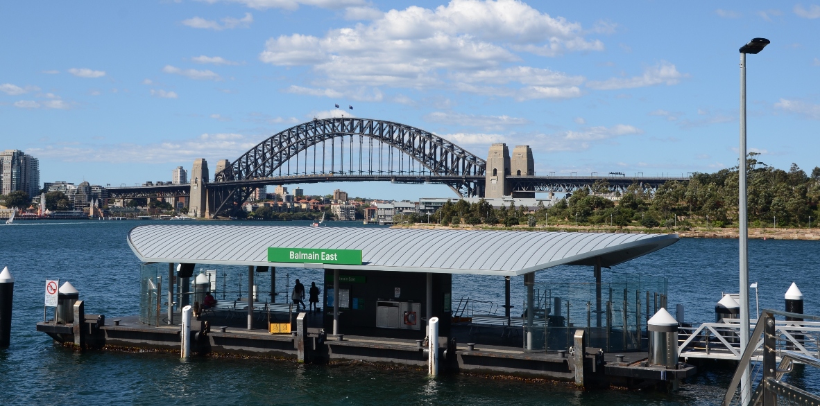
Callan Park exits out of Darling Street in Lilyfield. At the end of Thames Street off Darling is Balmain Wharf and Mort Bay Park. Once referred to as Mort’s Dock after Englishman Thomas Mort excavated the area to create a dry dock, in 1872 it was the biggest dockyard in the colony of NSW. Ballast Point and Yurulbin Park are other nearby waterfront parks. There is significant Aboriginal history all over the foreshores and the Inner West, but in Yurulbin Park signage outlines the frontier wars.
The Glebe Foreshore also winds around the water, and boasts Jubilee Park, Federal Park, Bicentennial Park and Harold Park. According to the Glebe Society, when the group formed in 1969, there was only one waterfront public open space in Glebe, Pope Paul VI reserve at the bottom of Glebe Point Road. Follow the Foreshore from Glebe Point into Blackwattle Bay and the Fish Markets.
Urban unwind

Victoria Park in Glebe across Broadway has a swimming pool and a pond, the bridges over which pathways point to the University of Sydney and the quadrangle, prominent due to its sandstone and built in Victorian Academic Gothic Revival architectural style.
Close by, Camperdown Park is a popular picnic and partying spot where dogs and teenagers usually make up the majority of park goers. King St is marked by restaurants and bars and the potential for a self-guided tour of the murals starting at the iconic mural: “I have a dream.”
The cemetery next door to Camperdown Park was established in 1849. Sydney’s main cemetery, the Sydney Burial Ground, was reaching capacity and additional burial sites were needed. The cemetery houses two infant children of NSW Premier Sir Henry Parkes.
Cooks corridor
Jennifer Kent, member of Friends of the GreenWay, said the light rail makes it possible to travel the GreenWay in a day.
Jennifer had just finished walking along the Cooks River when she spoke to the Independent.
“You could get on at Arlington and you could walk down some of the streets going past the corridor down Dulwich Grove and follow the signs down and you go to the beautiful Lang Road Bridge.”
The Cooks River is well trodden, with a shared path for pedestrians and bicycles that curves along the river and goes into and through many parks such as Gough Whitlam Park, Mackey Park, Steel Park, HJ Mahoney Memorial Park, the Marrickville Golf Club, Beaman Park and Ewan Park.
“I think a highlight of the whole path is the end of Lang Road Bridge,” she said.
“The old wooden bridge was just straight over, this one kind of curves so it opens the whole aspect of the river. It’s beautiful, and they’ve got a little canoe key or wharf.
“I’ve never seen so many people canoeing on the river,” she said.


